Track and manage your worksite vehicles in real time

Easily track and plan your vehicles and worksite machinery daily thanks to a comprehensive Track and Trace solution.

The advantages of managing your worksite vehicles with Traxxeo

Accurate tracking of the location of your worksite vehicles

  • GPS tracking of itineraries, location of your worksites and automatic alerts in the event of anomalies
  • Automated calculation of allowances for travel, mobility, presence time, inter-worksite time, etc.
  • Vehicle routes analysed to identify waiting and presence times 

A complete view of how your vehicles are used

  • Event and driver/passenger history
  • Improved responsiveness thanks to automatic alerts based on your work rules (speeding, km…)
  • Vehicle maintenance plan generated by odometer readings

Simplified business management thanks to automation

  • Automatic identification of driver and passenger to allocate hours worked per worksite
  • Automated calculation of allowances for travel, mobility, presence time, waiting time, etc.
  • Comparison of working time measured and reported using digital timesheets for better control

Optimise the management of your vehicle and worksite machinery fleet

Traxxeo’s geolocation software gives you a real-time view of the location of your vehicles and machinery. As a fleet manager, you can check in real time that your fleet is being used properly. You can also optimise itineraries between your worksites, analyse the utilisation rate of your fleet and ensure optimum management of your rolling stock.

Improve responsiveness with location data

Is a vehicle not where it should be? Be alerted immediately! Traxxeo's geolocation solution enables you to generate a series of alerts, sent automatically as soon as any behaviour does not comply with your management rules: a speeding driver, a vehicle used outside working hours, etc. Real-time analysis of location data gives you unprecedented responsiveness in the event of an anomaly, for greater safety of your vehicles and site machinery.

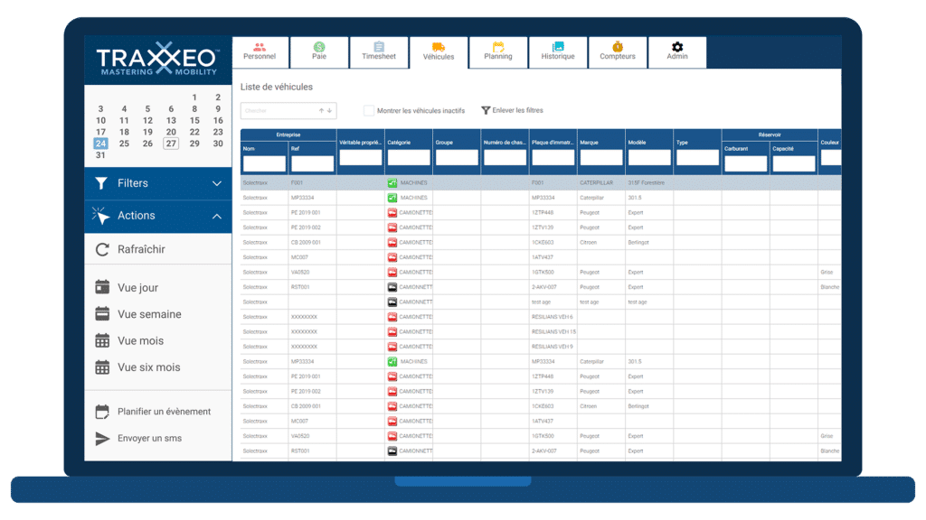
An online platform for a 360° view

Access the geolocation system wherever you are. The Traxxeo platform is accessible online and the geolocation data is constantly updated. The map gives you an overview of your vehicles' locations. The other views give you a detailed, up-to-date overview of how your fleet is being used. Consult precise usage and location histories, view drivers and passengers, optimise routes, and much more to ensure optimum fleet management.

Fleet management software for better control of vehicle-related costs

Your fleet of vehicles is one of your biggest investments. That's why it's so important to secure your vehicles and ensure that they are used properly. Route tracking and usage history allow you to optimise your routes and the allocation of your vehicles, to reduce your fuel consumption. Coupled with eco-driving, these are real levers for reducing the financial burden on your vehicle fleet. Eliminating theft and optimising maintenance plans are two other ways of reducing the costs associated with your rolling stock.
1. Responsiveness
2. 360° view
3. Better control

Master your human resources management with Traxxeo

Discover HR management tools designed for users. Drawing on its professional expertise, Traxxeo has developed time management tools tailored to the HR management of mobile teams. Its advanced features will help alleviate the workload for your HR teams and operational staff, while promoting a better social environment.

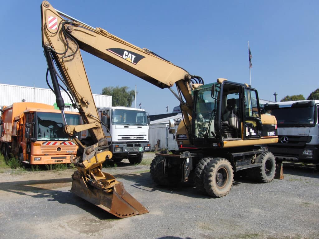
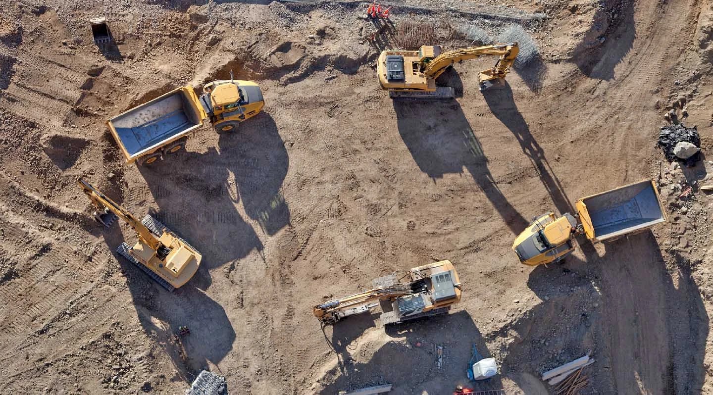
Geolocation software designed for the construction sector

Traxxeo is an expert in worksite resource management and offers a geolocation system dedicated to building professionals.

Benefit from advanced and specialised functions:

  • Worksite locations
  • Automated rebilling
  • Geolocation of vehicles using GPS trackers
  • Calculating mileage allowances
  • Planning by project
  • Allocation by project
  • Etc.

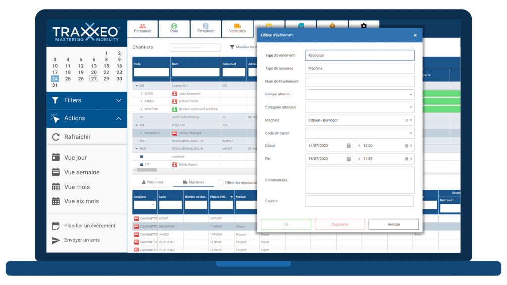
Complete fleet management with an allocation plan for your equipment

In addition to its geolocation solution, the Traxxeo platform also offers a material resource planning module. Easily assign your vehicles and worksite machinery to all your projects. Building professionals will particularly appreciate its site-by-site view, making it easy to specify equipment requirements for each project. At the click of a button, the equipment manager can view the available vehicles or machinery corresponding to the request, and allocate them by simply dragging and dropping. Optimise your material management, from planning to monitoring, to save time daily and make substantial savings.
1. Geolocation
2. Fleet management

Our expertise

Frequently Asked Questions

Vehicle geolocation software is designed to give businesses greater visibility and efficiency of their fleet. They allow fleet managers to monitor the location and status of their vehicles in real time, enabling them to make better, faster decisions. Overall, they facilitate considerable cost reductions through more efficient utilization of the vehicle fleet.
There are many vehicle geolocation software packages on the market, each offering different functionalities. Some software packages are better suited to small businesses, while others are better suited to large companies. The sector of activity is also an important factor to consider. The best geolocation software for your business will be the one that meets your specific needs. For building professionals, Traxxeo offers a powerful geolocation system, suitable for both medium-sized and large companies.
A GPS tracker is a device that tracks the position of an object or person in real time using data supplied by a network of satellites. These geographical coordinates (latitude and longitude) are then sent to geolocation software, which displays them as a map or analyses them to derive various data (speed of travel, position history, kilometres travelled, etc.).
Geolocation systems enable users to determine their position and locate themselves on a map, thanks to satellite tracking. These systems are based on technologies such as GPS (Global Positioning System, the most widely used, developed by the United States), GLONASS (Russian equivalent), GALILEO (European) and BEIDOU (launched by China). These systems enable geolocation software to find out the exact position of a user or an object and display this position on a map.

Any other questions?